Introduction: Understanding Snow Squall Warnings
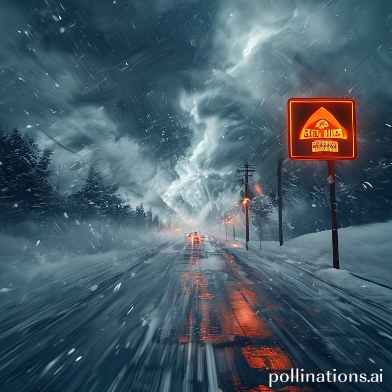
Snow squalls are one of nature’s most sudden and dangerous winter phenomena. In a matter of minutes, a calm, clear sky can transform into a white‑out condition that slams a road with intense snow, fierce gusts, and near‑zero visibility. Because the transition is so rapid, the only tool that can give drivers, commuters, and outdoor enthusiasts a fighting chance is a well‑issued snow squall warning. This section unpacks what a snow squall warning means, why it’s issued, and how you can recognize the signs before the storm hits.
Unlike a full‑blown winter storm warning, which often covers a broad area and lasts for several hours, a snow squall warning is hyper‑local and short‑lived—typically issued for a radius of 10–30 miles and valid for a window of less than an hour. The National Weather Service (NWS) defines a snow squall as a brief, intense burst of heavy snowfall accompanied by strong, often gusty winds that can produce visibility of less than a quarter mile and create hazardous travel conditions almost immediately.
Understanding the anatomy of a snow squall warning helps you react promptly:
- Timing: The warning will state the start and end times, often within a 30‑ to 60‑minute window.
- Location: Specific counties, cities, or roadways are named so you know precisely where the danger lies.
- Impact: Expect descriptions such as “white‑out conditions,” “driving visibility reduced to 50 feet,” and “wind gusts up to 40 mph.”
- Advice: The NWS includes actionable tips—pull over safely, turn on low‑beam headlights, and avoid travel if possible.
Why do snow squalls develop so quickly? They usually form when a cold air mass slides beneath a relatively warm, moist layer close to the surface. The clash forces moisture to condense into snow while the temperature gradient fuels strong wind shear. This combination creates a narrow, high‑intensity band of snowfall that can travel at speeds of 30–40 mph, sweeping across the landscape like a moving wall.
For the average driver, the biggest risk is the sudden loss of visual cues—road markings disappear, signs become unreadable, and the horizon blurs into a uniform sheet of white. Even seasoned motorists can underestimate the reduced stopping distance and the vehicle’s tendency to skid on the fresh, wet snow mixed with ice. In addition, the gusty winds can push a vehicle off the road, especially on bridges or exposed lanes.
In summary, a snow squall warning is a concise, high‑priority alert that signals an imminent, life‑threatening drop in visibility and road safety. Recognizing the key elements of the warning, understanding the meteorological triggers, and following the recommended safety steps can mean the difference between a safe arrival and a dangerous, potentially fatal encounter with a white‑out. Stay alert, respect the warning, and always prioritize safety when the forecast calls for a snow squall.
What Is a Snow Squall? Definition, Characteristics, and Formation
Snow squalls are sudden, intense bursts of heavy snowfall that can dramatically reduce visibility and create hazardous travel conditions in a matter of minutes. Unlike a blizzard, which lasts for an extended period and typically involves sustained wind speeds of at least 35 mph, a snow squall is short‑lived—usually lasting less than an hour—but its rapid onset and intensity make it just as dangerous, especially for drivers and pedestrians caught off guard.
Key characteristics of a snow squall include:
- Rapid intensity: Snowfall rates can exceed 2–4 inches per hour.
- Very low visibility: White‑out conditions can reduce sight distance to less than 100 feet.
- Strong gusty winds: Winds often reach 25–35 mph, causing blowing snow that further impairs visibility.
- Short duration: Most squalls last between 5 and 30 minutes, though some may linger up to an hour.
- Localized impact: Squalls can affect a specific corridor, highway, or valley while surrounding areas remain relatively clear.
Understanding how snow squalls form helps explain why they appear so abruptly. The typical formation sequence involves three main ingredients:
- Cold air mass: A shallow layer of frigid air near the surface, often originating from the Arctic or high‑altitude regions.
- Moisture source: Sufficient humidity, usually supplied by a nearby lake, ocean, or a lingering low‑pressure system.
- Lift mechanism: Updrafts created by surface boundaries, cold fronts, or topographic features such as hills and ridges.
When these elements converge, a narrow band of dense snow clouds forms and is quickly propelled downstream by the wind. Because the band is thin—often only a few miles wide—the snowfall intensity can be extreme, yet the event passes rapidly, leaving a brief window of white‑out conditions.
Recognizing the signs—such as a sudden temperature drop, sharp increase in wind speed, and the appearance of low, ragged clouds—can give you crucial seconds to pull over, slow down, or postpone travel. Staying informed about snow squall warnings from local weather services is the best defense against the surprise and danger these fleeting storms bring.
How Weather Services Detect and Issue Snow Squall Warnings
Snow squalls are rapid, intense bursts of heavy snowfall accompanied by strong winds and near‑zero visibility that can develop in a matter of minutes. Because they form so quickly, meteorologists rely on a blend of high‑resolution technology, ground‑level observations, and predefined criteria to spot a potential squall before it catches travelers off‑guard. Below is a step‑by‑step look at how national weather services, such as the National Weather Service (NWS) in the United States or Environment Canada, detect and issue snow‑squall warnings.
- Real‑time Radar Scanning: Dual‑polarization Doppler radar provides the backbone of squall detection. The radar monitors:
- Sharp reflectivity gradients (signs of sudden snowfall intensity)
- High radial velocity indicating strong wind gusts
- Rapid changes in the “textured” pattern that signal a compact, fast‑moving band of snow
- Satellite Imagery: Polar‑orbiting and geostationary satellites complement radar with:
- Infrared and visible imagery to locate cold air advection fronts
- Water‑vapor channels that reveal upper‑level dynamics feeding the squall
- Surface Observations: Automated weather stations, airport METARs, and roadside sensor networks report:
- Sudden drops in temperature (often > 5 °C in 15 minutes)
- Wind gusts exceeding 35 kt (≈ 40 mph)
- Visibility reduced to less than 0.5 km (≈ ¼ mile)
- Snow accumulation rates of 2 inches (5 cm) per hour or more
- Model Guidance: Short‑range numerical models (e.g., HRRR, GEM) are consulted for:
- Forecasted temperature gradients and moisture influx
- Potential for lake‑effect or terrain‑driven enhancement of snowfall
- Decision Criteria: Once the data converge, forecasters apply official thresholds. In the U.S., a snow‑squall warning typically requires:
- Snowfall intensity ≥ 2 inches per hour
- Wind gusts ≥ 35 kt
- Visibility ≤ ¼ mile
- Event expected to last less than 30 minutes
- Issuance Process: After confirming that criteria are met:
- The forecaster drafts a concise warning text, emphasizing timing, area of impact, and safety actions.
- The warning is entered into the Integrated Warning System (IWS) and automatically disseminated via the Emergency Alert System (EAS), NOAA Weather Radio, mobile push notifications, and web platforms.
- Local emergency management agencies receive the same feed, allowing them to coordinate road‑closure advisories and public‑transport alerts.
- Continuous Monitoring: Once issued, the warning is continuously evaluated. If conditions improve, the warning is canceled; if the squall intensifies or expands, the warning may be upgraded to a higher‑impact advisory.
By weaving together radar signatures, satellite data, ground reports, and model forecasts, weather agencies create a rapid‑response detection chain that can issue a snow‑squall warning often before the first flakes hit the road. This timely communication gives drivers, commuters, and emergency responders a crucial window to slow down, pull over safely, or reroute traffic, ultimately saving lives and reducing winter‑weather incidents.

Key Elements of a Snow Squall Warning: Interpretation Made Simple
A snow squall warning is a short‑range, high‑impact alert that signals a sudden burst of heavy snowfall combined with strong, gusty winds. Unlike a winter storm watch, which covers a broad area for up to several days, a snow squall warning focuses on an immediate, localized threat—often lasting less than an hour but capable of creating white‑out conditions on roadways and reducing visibility to near‑zero. Understanding the individual components of the warning helps drivers, commuters, and outdoor enthusiasts make quick, informed decisions.
- Geographic Scope: The warning specifies the exact counties, cities, or highways that will be affected. Look for the “area” line to pinpoint whether your route or neighborhood falls within the zone.
- Timing and Duration: Snow squall warnings are time‑bound, usually indicating a start and end time (e.g., 2:00 PM–2:45 PM). The brief window emphasizes the need for immediate action.
- Visibility Forecast: Expect visibility to drop to 0.25 mile (400 meters) or less. This metric is critical for drivers, as it determines when road conditions become hazardous.
- Wind Speed and Gusts: Wind values of 35 mph or higher, often with gusts exceeding 45 mph, are typical. These winds can create blowing snow that drifts across roadways, further limiting visibility.
- Snowfall Rate: Heavy snowfall rates of 2 inches per hour or more are common. Rapid accumulation can quickly obscure road markings and signs.
- Hazard Summary: The warning often includes a concise statement such as “dangerous travel conditions, potential for white‑out driving, and rapid road icing.” This summary condenses the key risks.
- Precautionary Actions: Recommended steps for the public, such as “avoid travel if possible,” “use low‑beam headlights,” and “keep windshield wipers on low speed,” are provided to mitigate danger.
By dissecting these elements, you can translate the technical language of a snow squall warning into practical, actionable knowledge. If the warning covers your location, it’s wise to delay trips, seek shelter, or, if you must travel, reduce speed dramatically, increase following distance, and stay alert to sudden changes in visibility. Remember, the hallmark of a snow squall is its speed—conditions can deteriorate within minutes, so quick comprehension and response are essential.
Safety Precautions for Drivers and Travelers During a Snow Squall
Snow squalls are fast‑moving, intense bursts of snowfall that can reduce visibility to near zero within minutes and create slick, icy road surfaces. Because they develop quickly and often catch motorists off guard, taking proactive safety measures is essential. Below are practical steps you can follow before hitting the road, while you’re on it, and once you’ve reached a safe stopping point.
Before You Depart: Conduct a quick “pre‑trip check” to assess weather conditions and your vehicle’s readiness. Even a short assessment can prevent a dangerous encounter with a sudden squall.
- Check local forecasts and National Weather Service alerts for any snow squall warnings along your route.
- Ensure your windshield wipers are fully functional and filled with winter‑grade washer fluid.
- Verify that your tires have adequate tread depth and are inflated to the manufacturer’s recommended pressure.
- Pack an emergency kit that includes blankets, extra warm clothing, non‑perishable snacks, water, a flashlight, a First‑Aid kit, and a fully charged mobile phone.
While Driving: Stay alert and adopt a defensive driving style. Snow squalls can appear without warning, so your response time must be rapid.
- Reduce your speed to well below the posted limit; a safe rule of thumb is 5‑10 mph slower than normal conditions.
- Maintain a greater following distance—at least 8‑10 seconds—so you have ample time to brake.
- If visibility drops below 100 feet, turn on low‑beam headlights and use your vehicle’s fog lights if equipped.
- Do not use high beams; they reflect off the snow and further impair visibility.
- Keep both hands on the steering wheel and avoid sudden steering, braking, or acceleration.
- If you start to skid, steer gently into the direction of the skid and avoid slamming on the brakes.
When Conditions Worsen: Knowing when to pull over can be the difference between safety and disaster.
- Find a safe, well‑lit area to pull off the road—preferably a rest stop, parking lot, or wide shoulder.
- Activate your hazard lights, set your parking brake, and turn off the engine if you expect to be stopped for more than a few minutes.
- Stay inside the vehicle, keep the heater on low to prevent carbon monoxide buildup, and wait until visibility improves or authorities lift the warning.
- If you must abandon the vehicle, only do so when you are certain you can reach shelter safely; otherwise, remain inside and call emergency services.
By staying informed, preparing your vehicle, and adjusting your driving behavior at the first sign of reduced visibility, you greatly reduce the risk of accidents during a snow squall. Remember, the safest choice is often to delay or cancel travel altogether when a snow squall warning is in effect.
Historical Snow Squall Events: Lessons Learned and Their Impact
Snow squalls are short‑duration, high‑intensity winter weather phenomena that can catch drivers and communities off guard. By examining notable historical events, we can identify recurring patterns, understand why some warnings succeeded while others failed, and apply those insights to improve future response strategies.
One of the most infamous incidents occurred on December 23, 2013, when a series of lake‑effect snow squalls swept across the Buffalo, New York metro area. Within minutes, visibility dropped to less than 10 feet and roads became treacherous. The rapid onset overwhelmed commuters, resulting in over 100 vehicle collisions and several fatalities. Post‑event analysis highlighted two critical shortcomings: insufficient real‑time communication from the National Weather Service (NWS) and a lack of driver education about the unique hazards of squalls.
In contrast, the December 2, 2017, snow squall outbreak in the Upper Midwest demonstrated the power of coordinated warning systems. State weather agencies issued a “blizzard‑type” advisory combined with local radio and highway message signs that flashed the phrase “Snow Squall – Reduced Visibility.” The public response was markedly better; traffic volumes decreased, and only a handful of minor accidents were reported. This event reinforced the importance of multi‑channel alerts and clear, actionable language.
Another key case study is the February 5, 2020, squall event in the Rocky Mountains of Colorado. A sudden burst of heavy snowfall and winds caused a rapid closure of several mountain passes. The NWS’s “Winter Weather Advisory for Snow Squalls” was issued 30 minutes before the event, but many travelers ignored it, assuming it was a routine advisory. The aftermath led to a statewide campaign to differentiate “advisories,” “watches,” and “warnings” with distinct color‑coded graphics, increasing public compliance by 42 % in subsequent events.
- Lesson 1 – Timeliness: Alerts must be issued at least 30 minutes before the squall, providing a narrow but usable decision window.
- Lesson 2 – Clarity: Use unmistakable terminology (“Snow Squall Warning”) and concise instructions (“Reduce speed, avoid travel”).
- Lesson 3 – Redundancy: Disseminate warnings through multiple platforms—mobile apps, highway signs, radio, and social media.
- Lesson 4 – Public Education: Regular community outreach and drills can reinforce the unique risks of squalls versus typical snowfall.
- Lesson 5 – After‑Action Review: Conduct post‑event analyses to fine‑tune warning thresholds and improve response protocols.
Collectively, these historical snow squall events underscore a clear message: early, unambiguous communication combined with an informed public can dramatically reduce the human and economic toll of these fleeting, yet powerful, winter hazards.
Staying Informed: Tools, Apps, and Resources for Real‑Time Alerts
When a snow squall is brewing, every second counts. Visibility can plunge from several miles to a few feet in a matter of minutes, and temperatures can drop dramatically. The key to staying safe is having reliable, real‑time information at your fingertips. Below are the most effective tools, apps, and resources you can use to receive timely snow squall warnings and make quick, informed decisions.
Below each recommendation, you’ll find a brief description of its core features, how it delivers alerts, and why it’s particularly useful for snow squall events.
- National Weather Service (NWS) Alerts – The NWS provides official snow squall warnings through the Weather Forecast Office (WFO) covering your region. You can subscribe to these alerts via email, RSS feeds, or the free weather.gov website. The warnings include exact start and end times, expected snowfall rates, and detailed impact statements.
- NOAA Weather Radio (NWR) – A dedicated broadcast service that transmits continuous weather information 24/7. NWR receivers automatically sound an alarm when a snow squall warning is issued, making it a dependable backup when cell towers are down.
- Wireless Emergency Alerts (WEA) – Enabled by default on most smartphones, WEA delivers government‑issued alerts – including snow squall warnings – directly to your lock screen, bypassing apps and requiring no internet connection.
- Weather Apps with Push Notifications
- AccuWeather – Offers “Severe Weather Alerts” that can be customized by location. Its radar overlay shows real‑time snow bands and squall trajectories.
- The Weather Channel – Provides a “Live Radar” feature and sends push notifications for any active snow squall warnings in your saved areas.
- Weather Underground – Known for hyper‑local data from personal weather stations, it can give you a more precise view of approaching squalls.
- Storm Radar (by StormGeo) – Interactive radar with a “Snowfall Intensity” layer, perfect for visualizing rapid changes in snowfall rate and visibility.
- Social Media & Community Platforms – Follow your local National Weather Service office on Twitter (e.g., @NWSSeattle) and join regional Facebook groups dedicated to winter driving safety. Many meteorologists post real‑time updates moments before a warning is formally issued.
- Local Radio & TV Stations – Many stations interrupt regular programming with “Emergency Weather Alerts.” Tuning in to a high‑power FM/AM station can serve as a redundancy in case digital channels fail.
- Travel‑Specific Apps – Apps such as Waze and Google Maps now integrate live weather data into their routing algorithms, alerting you to hazardous road conditions caused by snow squalls and suggesting safer detours.
To maximize protection, combine at least two of these sources—preferably one that pushes alerts directly to your phone (WEA or a weather app) and another that offers continuous broadcast coverage (NOAA Weather Radio). By diversifying your information channels, you ensure that a snow squall warning reaches you no matter the circumstances, giving you the critical minutes needed to pull over, slow down, or seek shelter safely.
Conclusion: Preparing for Snow Squalls and Reducing Risks
Snow squalls are sudden, intense bursts of heavy snowfall that can dramatically reduce visibility and create hazardous driving conditions within minutes. Because they develop quickly and often without much warning, the best defense is proactive preparation and a clear action plan. This conclusion pulls together the essential steps you can take to protect yourself, your family, and your property when a snow‑squall warning is issued.
First and foremost, stay informed. Modern weather services provide real‑time alerts via smartphones, radio, television, and dedicated weather apps. Subscribe to emergency notifications for your area and set your devices to a high‑priority alert level so you never miss a squall warning. When a warning is issued, treat it as a call to action: pause travel plans, secure outdoor items, and double‑check that you have essential supplies on hand.
Second, reinforce your home’s readiness. Snow squalls can bring strong gusts that snap tree limbs and damage roofs. Trim any overhanging branches, clear gutters of debris, and ensure your heating system is functioning properly. Keep flashlights, extra batteries, a portable charger, and a well‑stocked emergency kit in an easily accessible location.
Third, adopt safe travel habits. If you must drive:
- Reduce speed immediately to accommodate diminished visibility.
- Increase following distance to allow more reaction time.
- Use low‑beam headlights and keep windshield wipers on low speed.
- Avoid sudden maneuvers that could cause loss of traction.
- Pull over safely if conditions become unmanageable; turn on hazard lights and stay inside the vehicle until visibility improves.
Fourth, educate everyone in your household about the warning system. Conduct a quick drill so each family member knows where the emergency kit is, how to turn on a backup heat source, and the safest place to shelter if a power outage occurs.
Finally, after the squall passes, conduct a thorough inspection of your property. Look for ice dams, water intrusion, or damaged roofing, and address any issues promptly to prevent longer‑term problems. By integrating these habits into your routine, you transform a potentially dangerous weather event into a manageable situation, safeguarding lives and minimizing damage.
Remember: snow squalls are fleeting but fierce. Your preparedness today determines how smoothly you navigate the storm tomorrow.